Cosmos-Radar-Interferometrie
Innovative technology
SPACE-RADAR-Interferometrie
Choice and substantiation of the best places
for conducting engineering surveys in construction of
engineering objects and monitoring their further safe
operation.
Theoretical
fundamentals of technology -
space radar differential interferometry
Complete solution for the tasks of mine-surveyor-geodesic monitoring industrial facilities , deposits and transport pipelines with using modern satellite methods.
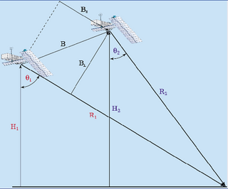
Scheme for space imagery interferometry pairs of images
Data
sources:
- radar and multispectral space
survey;
- aviation laser
scanning;
- a priori geological and
engineering information
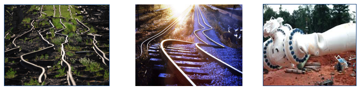
Examples of the impact of natural hazards on engineering objects
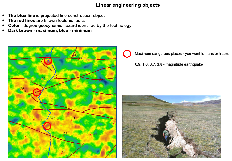
Result:
ahead-of-field engineering
surveys choice of place for construction sites and routes of
roads and pipelines, the most favorable in terms of minimizing
the impact on the projected industrial objects, natural hazards
(earthquakes, tectonic breaks, kripp, karst, landslides etc)
and technogenic-initiated (subsidence of a terrestrial surface
in relation to mining);
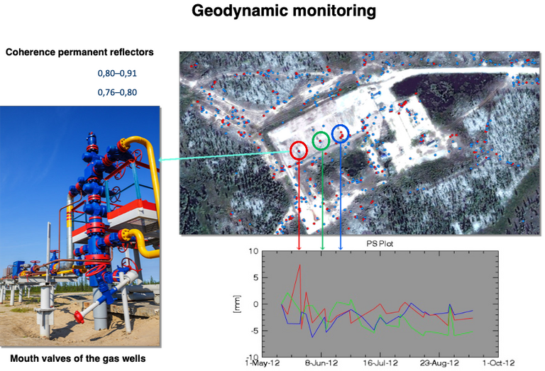
When monitoring the existing
utility facilities (hydroelectric dams, bridges, hydrocarbon
deposits, pipelines etc) – identification of the places most
affected by hazardous natural processes and phenomena to
develop solutions to eliminate or minimize such impacts.